
16 people are now known
to have lost their lives in Bukoba after the magnitude 5.9 earthquake struck in
Tanzania on 10 September. 253 people have also been injured. The earthquake was
updated from a magnitude 5.7 to 5.9 by USGS after verification. The depth of
the earthquake was also updated from 10 km to 40 km.
The search and rescue
phase is now over and it is believed that no further victims have been trapped
under the collapsed buildings in the worst hit town of Bukoba. The governor of Kagera, claimed that 15 of
the victims were secondary school boys from a boarding school.
According to the regional
UN coordinator, an estimated 400 buildings have been destroyed or damaged. The
number of victims displaced by the earthquake is not yet known. A full damaged
assessment will be undertaken over the next few days.
Bukoba has been the worst
affected town. Homes and business have been severely damaged or destroyed, infrastructure
such as roads have been damaged and electricity and communication lines have
been disrupted. Shocking photos of the damage in the town can be seen below or
on the previous blog.
The intensity felt in
Bukoba is a VI on the Modified Mercalli Scale, indicating strong shaking as
shown on the image below.

(Source: USGS)
On the night of 11
September, an aftershock lasting around 20 seconds was felt in Bukoba. Although
the magnitude is not currently known, the intensity was felt by the population
including my family who experienced the house shaking. Residents panicked and
ran outside in fear of further earthquakes and aftershocks occurring.
Some houses which have
experienced severe damage are unsafe to live in and will probably need to be
demolished. Aftershocks may further weaken these structures and therefore it is
advisable to seek shelter elsewhere.
Did
you feel the aftershock? Let us know!
Want to listen to the waveform as an audio? Click on the link and listen: IRIS Incorporated Research Institutions for Seismology
Towards the end of this video, you can witness the TRA Commissioner giving a speech when the earthquake struck, they ran out of the building.


Damage in Bukoba (Photographer unknown)


Damage in Bukoba (Photographer unknown)

Damage in Bukoba (Photographer unknown)

Damage in Bukoba (Photographer unknown)
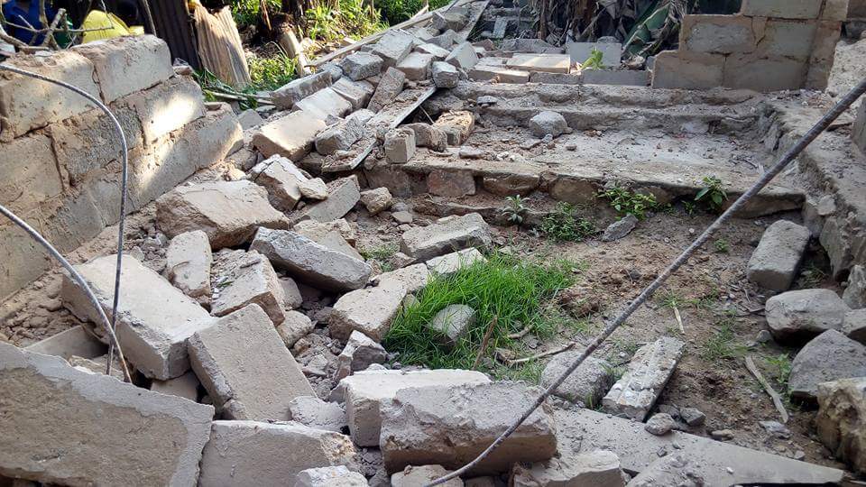

Damage in Bukoba (Photographer unknown)


Damage in Bukoba (Photographer unknown)


Damage in Bukoba (Photographer unknown)


Damage in Bukoba (Photographer unknown)
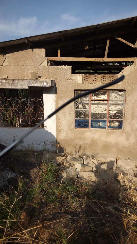

Damage in Bukoba (Photographer unknown)


Damage in Bukoba (Photographer unknown)


Damage in Bukoba (Photographer unknown)


Damage in Bukoba (Photographer unknown)
Technical Background:
According to the USGS, the
earthquake was caused by shallow oblique faulting within the Africa plate. The
East African Rift System is active and responsible for the numerous earthquakes
and volcanoes. It is 3000 km long.
Saturdays earthquake occurred
an estimated 200 km east of the West Branch of the Rift System and hundreds of
km to the east of the East Branch. The Victoria microplate, which is located
between the East and West Branch is at a divergent plate boundary where two plates
move away from each other. According to USGS, Saturdays earthquake occurred around
the centre of this microplate which has little or no records of earthquakes. The
earthquake location is also rare since seismicity is generally located along
the Rift System. USGS also mention that this earthquake was caused by the mixed
divergent and strike slip setting between the microplate and Rift System.
In December 2013 a
Magnitude 4.4 earthquake occurred within a boundary of 100 km of Saturdays
earthquake. 22 Magnitude 6 and above (including a magnitude 6.6 earthquake in
1966 near Lake Edwards) have also occurred within 500 km of Saturdays earthquake.
The largest earthquake to
occur in Tanzania was a magnitude 7.2 in July 1919. The earthquake was located
near Lake Tanganyika. On 5 December 2005, a magnitude 6.8 earthquake
struck the Lake Tanganyika region at 15:19 local time. 5000 people were
affected by this earthquake and one fatality was reported. The earthquake
destroyed 54 houses across 11 villages and damaged 705 others. A detailed
report of the response to this earthquake can be found here: 2005 Earthquake Report
For further technical information,
you can visit the USGS website. USGS Event page

Seismograph of the 10 September earthquake. The recording station is located in Uganda
(Source: IRIS)

Seismograph of the 10 September earthquake (Source: IRIS)

Seismograph of the 10 September earthquake from various monitoring stations (Source: IRIS)

Seismograph of the 10 September earthquake. The recording station is located in Kenya
(Source: IRIS)

Seismograph of the 10 September earthquake. The record station is located in Kenya. You can see the phase arrivals of the P and S waves. (Source: IRIS)

The Tanzania Red Cross
Society is responding to the disaster and if you would like to donate to them
to help the victims of the earthquake, follow the link: Tanzania Red Cross Donation Page
No comments:
Post a Comment