
Two earthquakes occurred in Central Italy on 26 October. The first earthquake measuring a magnitude 5.5 occurred at 17:10 UTC 8 km east south east of Sellano and 2.9 km (1.8 miles) South South West of Preci. The second earthquake measuring a magnitude 6.1 occurred at 19:18 UTC 3 km (1.9 miles) West of Visso. Both earthquakes had a shallow depth of 10 km (6.2 miles).
There has been reports of injuries and one fatality. A 73 year man died of a heart attack due to the earthquake. Fortunately no more fatalities have been reported so far.
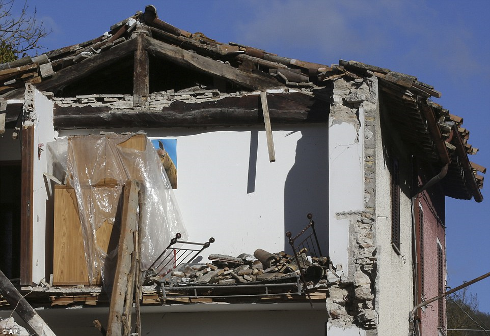
Numerous buildings have been damaged or destroyed including a 14th century church which collapsed. Visso, Ussita and Castel Santangelo Sul Nera are the worst affected towns. The buildings in this region had already been weakened by a magnitude 6.2 earthquake on 24 August which killed nearly 300 people.
Infrastructure including roads, electricity and communication cables were also affected by the earthquake.
Many residents stayed outside following the first earthquake. This may have saved many lives after the larger magnitude earthquake occurred over 2 hours later.
A full damage assessment is currently underway.
8 aftershocks have occurred following the two earthquakes yesterday, these have varied in size from a magnitude 4.0 to 4.9. The map below shows the locations and magnitudes of the smaller aftershocks.
According to USGS these earthquakes were aftershocks of the main earthquake on 24 August. The magnitude 6.1 is intraplate earthquake and was a result of shallow normal faulting.
The poster below by USGS summaries the details of the earthquake.

USGS Poster Summary of Magnitude 6.1 earthquake (Source: USGS)

Seismic waveform of Magnitude 6.1 (Source: IRIS)

Community Intensity Map Magnitude 6.1 (Source: USGS)


Estimated population exposure to shaking, Magnitude 6.1 (Source: USGS)

Cities exposed to shaking, Magnitude 6.1 (Source: USGS)


PGA and PGV, Magnitude 6.1 (Source: USGS)

ShakeMap showing intensity of Magnitude 6.1 earthquake (Source: USGS)

Magnitude 5.5 seismic waveform (Source: IRIS)

Community Intensity map Magnitude 5.5 (Source: USGS)


Estimated population exposure to shaking, Magnitude 5.5 (Source: USGS)


PGA and PGV, Magnitude 5.5 (Source: USGS)

ShakeMap, Magnitude 5.5 (Source: USGS)

Locations and magnitudes of the aftershocks following the 2 earthquakes (shown in red) (Edited from USGS)


The video below is in Italian but shows the damage and collapse of buildings.
No comments:
Post a Comment